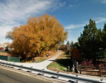
Left Hand Greenway
Left Hand Greenway
Hours of use for Greenway Trailheads and Greenway Lands is 1 hour before sunrise to 1 hour after sunset, while the Greenway Trail itself is open 24 hours, 7 days a week given there is continuous movement on the trail. Learn more about rules and regulations on public lands.
Overview
The Left Hand Greenway trail is in place from the St. Vrain Creek to Hover Street. The trail connects to the Longmont Recreation Center and Longmont Museum, Kanemoto Neighborhood Park and Left Hand Creek Neighborhood Park–all located along Left Hand Creek. Named after Chief Niwot (translated from the Arapaho language as “left hand”), the creek flows from Left Hand Canyon through south Longmont, where mature willow and cottonwood trees grace its banks.
For more information, contact Parks, Open Space & Trails.
Trail Distance to Landmarks
(shown in miles)
| Left Hand Greenway |
St. Vrain Greenway |
Recreation Center Trail |
Main St. |
South Pratt Pkwy. |
Bowen St. |
Pike Road |
Sunset St. |
Hover St. |
||
|---|---|---|---|---|---|---|---|---|---|---|
| St. Vrain Greenway |
— |
0.4 |
0.8 |
1.1 |
1.6 |
2.0 |
2.4 |
2.9 | ||
| Recreation Center trail |
0.4 | — |
0.4 |
0.7 |
1.2 |
1.6 |
2.0 |
2.5 |
||
| Main Street |
0.8 |
0.4 |
— |
0.3 |
0.8 |
1.2 |
1.6 |
2.1 |
||
| South Pratt Pkwy (Kanemoto Park) |
1.1 |
0.7 |
0.3 |
— |
0.5 | 0.9 |
1.3 |
1.8 |
||
| Bowen Street |
1.6 |
1.2 |
0.8 |
0.5 |
— |
0.4 |
0.8 |
1.3 |
||
| Pike Road (Left Hand Creek Park} |
2.0 |
1.6 |
1.2 |
0.9 |
0.4 |
— |
0.4 |
0.9 |
||
| Sunset Street |
2.4 |
2.0 |
1.6 |
1.3 |
0.8 |
0.4 |
— |
0.5 |
||
| Hover Street (LOBO Trail) |
2.9 |
2.5 |
2.1 |
1.8 |
1.3 |
0.9 |
0.5 |
— |
||
