Building on the multi-year restoration effort of Resilient St. Vrain, the Hover Reach will continue to protect people and property while enhancing the river corridor. The creek improvements will tie into the ongoing construction project along Izaak Walton pond and widen the existing channel to contain the 100 year floodplain.
During the 2013 flood, water spilled out of the southern bank of the creek upstream of Hover St. and flowed southeast through the Fairgrounds creating a split flow. This project will capture that split flow by building a new bridge on Hover St. just north of the intersection with Boston Ave./Rogers Rd. and redirecting the water through Fairgrounds Pond and back into the creek. The two images below show how the floodplain will be improved by comparing the existing flooding depth in a 100-year event and how the built project will reduce this area.
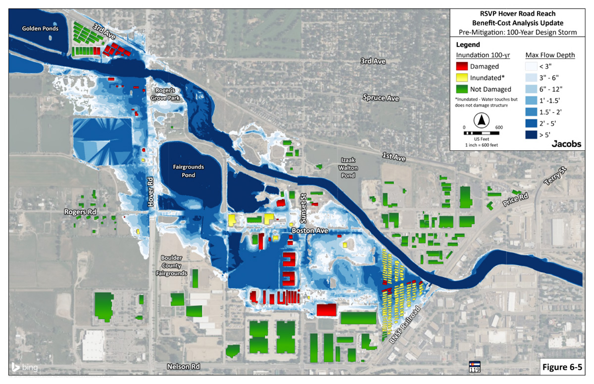
A map of existing flooding depth in a 100-year event.
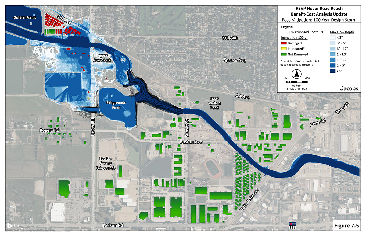
A map of flooding depth in a 100-year event after Hover Reach is completed.
The project is nearing the end of the preliminary 30% design. This project started January 2025 and is expected to be completed in Fall 2029.
The primary goal of this project is to contain the creek during larger rainstorms. This will remove property and structures from the floodplain. A new bridge with a channel designed to capture the flow that escapes the river bank upstream of Hover will redirect the water through Fairgrounds Pond and rejoin it with the main stem of the creek. Improvements to the creek channel will widen the floodplain and enhance the vegetation producing a natural stream appearance and function. Nature-based design principles will be used similar to the other reaches of RSVP.
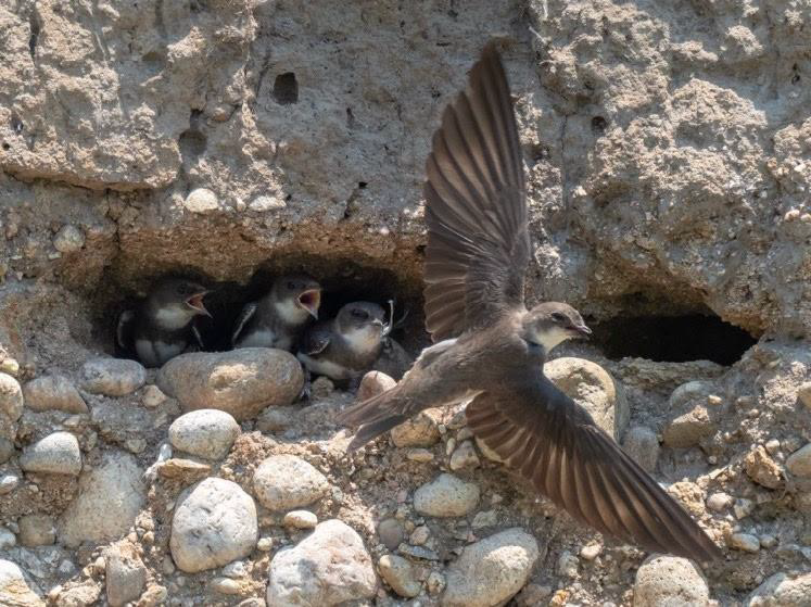
Bank swallow nest. Photo by Scott Severs.
Throughout the planning and implementation of the Resilient St. Vrain Project (RSVP), the City has considered how the project may impact the ecology of the St. Vrain Creek corridor and has worked to mitigate any potential impacts.
Within the Hover Reach of RSVP, there exists nesting habitat for a species of bird called bank swallows. This species nests in excavated cavities on steep banks along streams. With the necessary modifications to the creek in this reach, the nesting habitat will not be able to be retained. Knowing this, City wildlife biologists researched ways to mitigate this impact and produced a report that identified a preferred alternative.

An artificial bank made of fine-grained material like sand with a steep face that the bank swallows can excavate to create their nest.
That alternative is to build an artificial structure that mimics the type of habitat that bank swallows nest in. Essentially, the structure is a pile of fine-grained material like sand that has a steep face that the birds can excavate into. This method has been shown successful in Canada. Currently staff are evaluating potential locations to build the artificial habitat and are refining construction specifications with a plan to have it built by the time bank swallows migrate back to the area at the beginning of April.
Design January 2025 – October 2026
Construction 2027-2029
Past work on RSVP has incorporated the feedback from the community. During the next stage of design, additional outreach and opportunity for feedback will be available.