Welcome to the City of Longmont Public Lands Map! This map provides one convenient location to find Parks, Greenways and Open Space fast with links to additional pages for more specific information.
Save this map in your favorites to help plan a fun day out around Longmont! Use this map to:
- View outdoor spaces open to the public throughout Longmont
- Find parks, trails, and nature areas near you
- Search for specific features of interest such as bike parks, sport courts, & water activities
- Find local nature areas and preserves for passive recreational activities
- Click links for more information on individual parks, trail closures, & art in public places
Click on the map below to visit the Public Lands web map and explore your public lands:
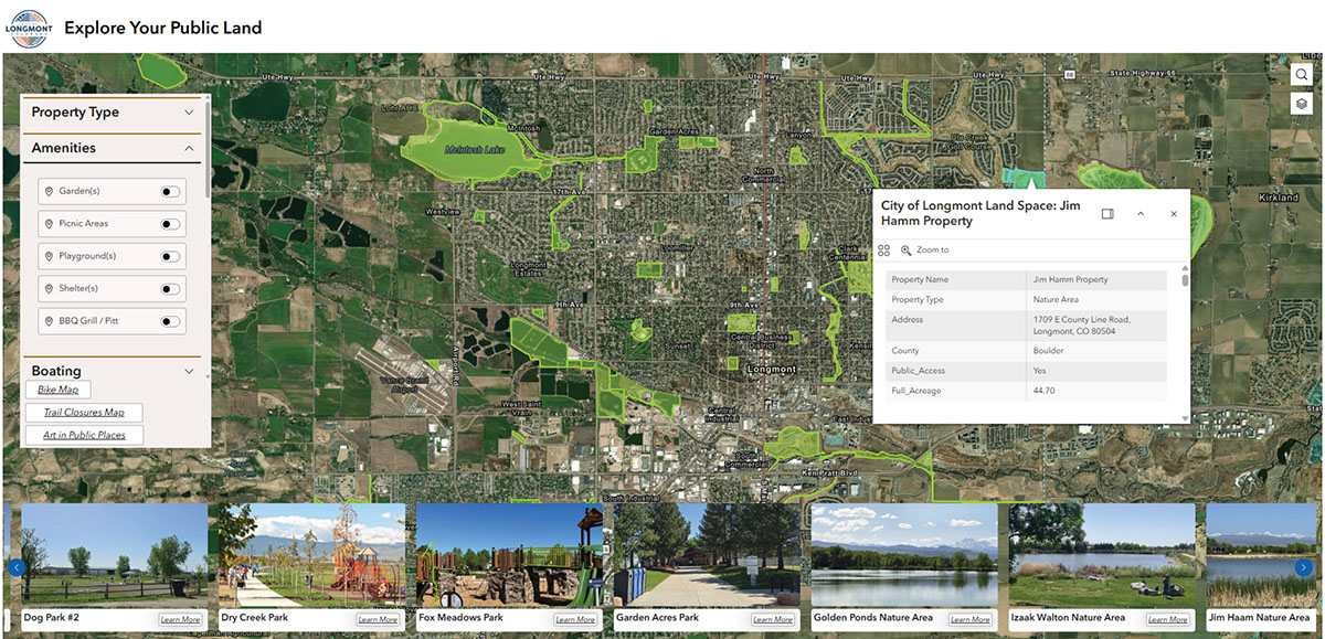
To use the map:
- Toggle or zoom on the map with clickable areas of public access.
- Use the dropdown menus on the left of the map to highlight areas with specific features or amenities.
- Scroll through places at the bottom of the page to access site specific pages.
- Click on the image to navigate to that area of the map.
- Click on “Learn More” to visit the facility webpage.
Have questions? Contact our GIS experts online or call 303-776-6050.