Phase 12 is planned to extend the St. Vrain Greenway trail west from Golden Ponds Nature Area to Airport Road, linking Longmont’s portion of the St. Vrain Greenway trail to Boulder County’s planned trail route.
The western portion of the St. Vrain Greenway trail, which is part of the statewide Colorado Front Range Trail, will ultimately provide a connection between the City of Longmont and the Town of Lyons through the diverse agricultural and natural landscape of the St. Vrain River Valley.
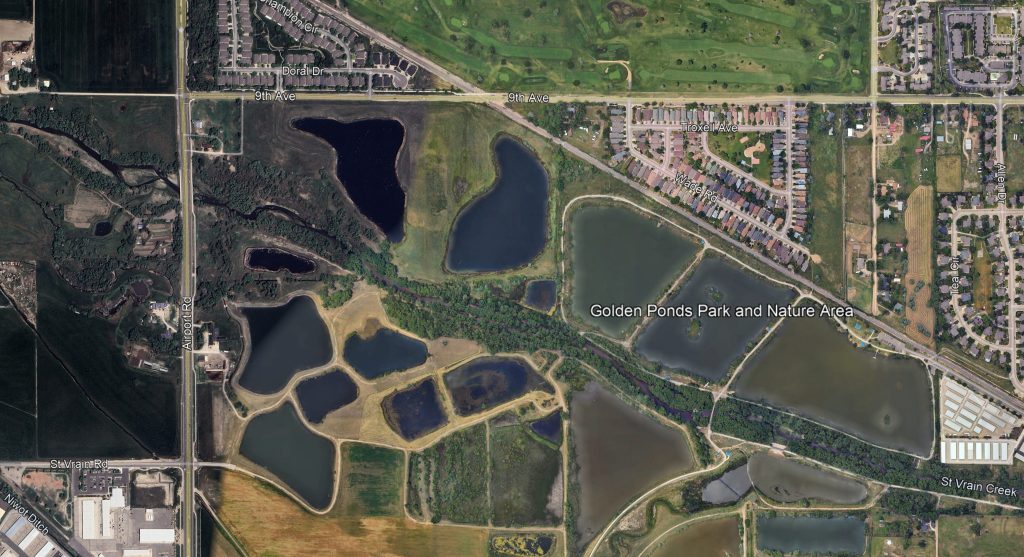
Phase 12 is the final phase needed to complete the St. Vrain Greenway trail originally envisioned in the original 1993 St. Vrain River Greenway Master Plan. Phase 12 will include a connection from Golden Ponds Nature Area west to Airport Road, completing the City of Longmont’s St. Vrain Greenway Trail.
In 2004, the City of Longmont adopted the St. Vrain Trail Master Plan. The 2004 Master Plan was the product of a collaborative effort between Boulder County Parks and Open Space, City of Longmont, consultant staff, key stakeholders, and local residents. The 2004 Master Plan identified the most viable alternative at that time for a recreational trail along the St. Vrain River corridor between the City of Longmont’s Golden Ponds Nature Area and the Town of Lyons.
Funding for St. Vrain Greenway Phase 12 design and construction was reallocated to St. Vrain Greenway trail flood repair after the September 2013 flood. Project funding is anticipated to be restored beginning in 2026.
Information on the flood repair projects can be found on the Resilient St. Vrain Project webpage.
- Design Bid – Upcoming, expected 2026
- Design – Upcoming, expected 2026
- Construction Bid – Upcoming, expected late 2026 / early 2027
- Construction – Upcoming, expected 2027 – 2029